 Nayarit’s farmers benefit from its location in a fertile valley, and with 181 miles of coastline, the state is a top tourist destination. Tourism and other service industries account for about 24 percent of the state’s economy. Agriculture also supports the economy, with tobacco, sugarcane and tropical fruits being among the chief crops. Small factories manufacture tequila, leather goods, textiles and wooden products.
Early History
Although humans may have settled in Nayarit as early as 5,000 B.C, the first known civilization in the region, the Cora, appeared sometime around 400 A.D. Concentrated on the Nayar plateau of the Sierra Madre Occidental, Cora society reached its apex about 1200 A.D.; many of their descendants continue to live in the area. The Cora relied on agriculture, and cultivated beans, corn and amaranth.
From the 9th to the 12th century, other tribes migrated into the region, including the Tepehuano, Totorano and Huichole. Over the next 300 years they were driven back by tribes from the Indian civilizations of Xalisco. These tribes were members of the Chimalhuacán Confederation.
Middle History
In 1523, Spanish conquistador Hernán Cortés briefly visited Nayarit. He was followed five years later by Nuño Beltrán de Guzmán, infamous for his ruthlessness in overthrowing indigenous leaders. Beltrán de Guzmán conquered many villages in the region and founded the settlement of Espíritu Santo on the ruins of the indigenous city of Tepic. In 1531, Cortés returned and tried to take control of the area, but Beltrán de Guzmán appealed to the Spanish crown and was named governor of a province comprised of the territories he had conquered.
In 1536, Diego Pérez de la Torre replaced Beltrán de Guzmán as governor. He ruled only two years, however, before being killed during an indigenous revolt in 1538. Throughout most of the 16th and 17th centuries, Franciscan priests of the Roman Catholic Church sought to convert and pacify the Cora, who fiercely resisted Spanish occupation. Spanish control of the region was constantly threatened by indigenous revolts, such as the famous uprising led by Tenamaxtli in the 1540s. Rebels in the Nayar mountain range continued to harass the Spanish until they were finally conquered in 1722.
Mexico began its march toward independence in 1810 under the leadership of Miguel Hidalgo. In Nayarit, a local priest named José María Mercado took up the cause, occupying the capital city of Tepic without a battle in November 1810. By December he had also captured the port of San Blas, but his success was fleeting. Within a year, royalist forces had recaptured most of Nayarit. Even so, the larger revolution eventually succeeded, and Nayarit became a part of independent Mexico in 1821.
Recent History
Under the first Mexican constitution in 1824, Nayarit was made a region of neighboring Jalisco. In the 1830s and 1840s national politics were dominated by conflicts between centralists and federalists and in the 1850s and 1860s by clashes between liberals and conservatives. The liberals finally consolidated their power under President Benito Juárez, who shaped the future of Nayarit by separating Tepic from Jalisco in 1867. The city was not an independent state, however; it instead became a military district of the Mexican Federation.
Soon after Juárez left the presidency, Porfirio Díaz rose to power, ruling Mexico from 1877 to 1880 and again from 1884 to 1911. During this period, Nayarit–like many states in Mexico–enjoyed economic growth due to improvements in transportation and communication. Increased prosperity was concentrated in the hands of a few, however, and most of the region’s inhabitants remained poor. Social unrest brought about the Mexican Revolution of 1910, when Francisco I. Madero led the effort to overthrow Díaz.
Although Díaz was removed from power in 1911, the war continued as various revolutionary factions battled among themselves. Forces loyal to Madero, Francisco “Pancho” Villa and Venustiano Carranza fought for control of the government in Nayarit. When the government adopted a new constitution in 1917, Nayarit was declared a federal state, and a brief period of peace and prosperity followed.
Like the rest of Mexico, Nayarit was under the political control of the Partido Revolucionario Institucional (Institutional Revolutionary Party) from the beginning of the 1930s to the latter part of the 20th century. Under their leadership, the region experienced a surge of economic development and political stability.
NAYARIT TODAY
For many years, one of the most significant contributors to the economy of Nayarit has been tobacco production. Two of Mexico’s largest tobacco companies are headquartered in the state, and a major cigarette factory operates in Tepic.
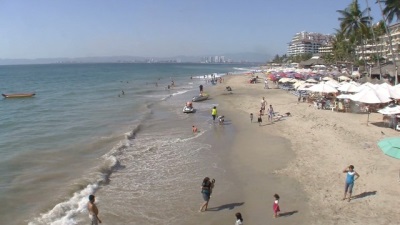
Although tourism is increasing, Nayarit’s coastline is still largely undeveloped, enabling visitors to surf and swim on beautiful, uncrowded beaches. The state is home to some of the best snorkeling in western Mexico, especially in the Las Marietas archipelago.
The government program Tepic Ciudad Blanca coordinates citizen initiatives to make the city cleaner and safer through trash collection and recycling, graffiti removal and neighborhood crime watches.
FACTS & FIGURES
Capital: Tepic
Major Cities (population): Tepic (336,043) Santiago Ixcuintla (84,314) Valle de Banderas (83,739) Compostela (62,925) San Blas (37,478)
Size/Area: 10,417 square miles
Population: 949,684 (2005 Census)
Year of statehood: 1917
FUN FACTS
The renowned painter Diego Rivera designed Nayarit’s coat of arms in 1921. A corn plant fills the upper left portion of the emblem, symbolizing the state’s capital, Tepic, the name of which comes from the Aztec word for corn, tepictu. At the upper right a golden bow and arrow represent Nayarit, the god of war worshipped by the Cora, the region’s most prominent indigenous tribe; Nayarit is said to have invented the bow and arrow. At the bottom, white peaks signify the Sierra Madre Occidental, a mountain chain that was home to the Nayar kingdom in the 1500s. At the center of the coat of arms, a small shield depicts an eagle eating a snake on a cactus, the nation’s symbol. Seven footprints encircle the small shield, representing the seven Aztec tribes that walked from the mythical Aztlán to their new home at
Tenochtitlán.
Nayarit is one of the smallest Mexican states. Only Aguascalientes, Colima, Morelos, Tlaxcala and the Federal District are smaller.
One of Nayarit’s typical dishes is called cucaraches de camaron (shrimp cockroaches), although it contains no insects.
Luis E. Miramontes, chemist and co-inventor of the contraceptive pill, was born in the state’s capital, Tepic.
Nayarit has an unusual combination of both tropical and temperate ecosystems. About 300 species of orchids can be found there. Notable wildlife includes crocodiles, sea turtles, jaguars, humpback whales and 400 species of birds.
The Las Palmas crocodile refuge in San Blas manages a breeding program and offers visitors the chance to see many of the large reptiles in their natural environment.
The Spanish priest Junipero Serra, who founded many of area missions, embarked on his journey at the port of San Blas.
Henry Wadsworth Longfellow’s 1882 poem The Bells of San Blas portrays the city as a link between the past and present. More recently, the Mexican rock group Mana recorded a song, El Muelle de San Blas (The Pier of San Blas) about the city.
The archipelago Islas Marías lies about 115 kilometers (70 miles) off the coast. Since 1905 these islands have served as a federal penal colony where prisoners work and live with their families.
LANDMARKS
Tepic’s eclectic architecture showcases the city’s varied history. The city’s oldest building is the church of La Cruz de Zacate, famous for a natural grass cross that maintains its shape and color without cultivation. Adjacent to La Cruz de Zacate is a former convent, built in 1784, where Junípero Serra resided before founding missions in Baja California and the U.S. state of California. A more recent building is the neo-Gothic Cathedral of Tepic, erected during the 19th century; its two main towers rise 40 meters (132 feet).
Archaeological Sites
Los Toriles, also known as Ancient Ixtlán, is the region’s only major archaeological site. Náhuatl people are believed to have occupied Los Toriles between 300 B.C. and 600 A.D., building columns, porticos, plazas, interior patios, avenues and stairways that survive today.
Islands
Many islands dot the Pacific Ocean off the coastline of Nayarit, including Las Marietas, Islas Marías and Isla Isabela.
Las Marietas, a small archipelago near Puerto Vallarta, is perfect for diving, snorkeling and camping. The natural reserve attracts tourists who come to observe humpback whales. Each year these giant mammals swim over 6,000 kilometers (4,000 miles) from Alaska’s icy seas to mate in the warm waters of Banderas Bay.
The Islas Marías are located 115 kilometers (70 miles) west of San Blas. The four main islands–María Madre, María Magdalena, Cleofas and San Juanico–have a total area of 274 square kilometers (106 square miles). María Madre, the largest island, has been used as a penal colony since 1905. The three smaller islands are inhabited by government officials and religious workers.
The small island of Isla Isabel, 74 kilometers (46 miles) from San Blas, is an ecological reserve that provides sanctuary to several unique bird species, including the tijereta (a kind of hummingbird), various types of bobo, pelicans and seagulls.
Beaches
Visitors to Destiladeras, El Anclote and Punta de Mita enjoy coral reefs, turtles, manta rays and lobsters. Los Ayala and Frideras are known for their golden sand, jungle vegetation and blue-green waters.


 The 6.2-magnitude earthquake struck off Mexico's Pacific coast, around 300 km from some of the country's beach resorts.
 The festival will be in September and is currently in the phase of organization with the Ministry of Tourism, said Carlos Vogeler, Americas director of OMT.
 Upon arriving in Destiladeras, you will be enraptured not only by the beautiful scenery of the bay, but also by the family-friendly and welcoming ambiance that can be felt all along the five kilometer (three-mile) beach.
 Thanks to this newest accolade, the Riviera Nayarit confirms its place as the second tourism destination with the most luxury hotels in all of Mexico, with 14 resorts having laid claim to AAA Diamonds.
 The first hurricane of the eastern Pacific hurricane season, Hurricane Amanda, formed Thursday afternoon as a tropical depression about 635 miles south-southwest of Manzanillo, Mexico, and is moving toward the west-northwest. A turn more toward the north is likely later this weekend into early next week. Other than a few minor islands well offshore such as Socorro Island, it is no threat to land.
 Soon it will begin working with secondary schools, including through partnerships with educational institutes and universities.
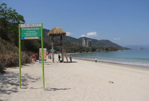 Puerto Vallarta: This Friday was born the first tropical cyclone of the season off the coast of the Mexican Pacific, Tropical Depression Number 1, which by their remoteness poses no risk to the region, however will lead to increased heat.
 This amazing house, whose design was inspired by Sea, is located in Mexico, City. Arquitectura Orgánica built the house in 2006. Resembling a Nautilus shell, it showcases a prominent entry cut into a wall of colorful stained glass. The interior features amazing network of stone paths (grass carpet) that runs through the various areas of the home. But it’s not the only surprise you will find. The bathroom is adorned with gorgeous blue tiles.


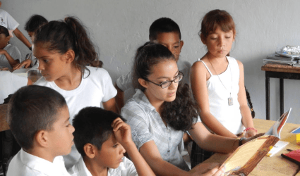 Libros for Learning is a 501c3 tax deductible organization dedicated to building children’s libraries in the Cabo Corrientes area of Mexico. Schools in rural Mexico work hard to deliver quality education, but struggle against some built-in challenges. A typical rural school consists of a single room building filled with over 30 children ages 5-15 and a single teacher. These schools lack many basic of resources for their students, including pencils and paper, crayons and notebooks. Most importantly they lack books!
 Puerto Vallarta, Mexico (CNN) -- It's the life Sara Wise always dreamed of: a place with unbeatable weather, sunny beaches, good medical care and an active social life -- and all at very affordable prices.
 In a few days the hurricanes season 2014 for the Atlantic, Caribbean Sea and Gulf of Mexico will start and better than knowing the forecast is the importance of being prepared, stated today a Cuban expert.
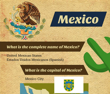 What is the complete name of Mexico ?